Tunitas Creek Road
Highway 1 south of Montara is a flat, straight road with a tailwind—serious big-ring territory, wide, with a lot of traffic. Tunitas Creek is a 15km long climb with 600 meters of altitude gain, with no traffic. They’re both outstanding rides for completely opposite reasons. And there’s also a spectacular descent on Kings Mountain Road, so this route makes everyone happy, if they’re in shape for it. Once you leave Pacifica there’s really no viable bail-out until Palo Alto, and after Half Moon Bay no civilization until Woodside (some 40km)
Route Maps
Advanced (97km)
Start: Colma, End: Millbrae
Road notes
High Street/San Pedro/Eastmoor/Westmoor
To get out of the BART station, it’s easiest to go through the parking garage, exit on High Street, and then take San Pedro over the freeway to Eastmoor. Eastmoor and Westmoor are usually moor-like; cold and foggy. The route is a gradual climb through a residential area.
Skyline Drive/Crenshaw/Palmetto
Cross over the main Skyline Boulevard and turn left on the parallel Skyline Drive, which climbs through a residential neighborhood. After the peak there’s a fast descent; at a downhill right-hand curve near a school, be prepared to turn left on Crenshaw and then immediately right on Palmetto. Palmetto continues descending with a beautiful left-hand curve as you reach the ocean.
Paloma/Beach/Lakeside/Bradford/Mori Point
Once you get to downtown Pacifica, a right turn on Paloma takes you out to this series of roads by the beach. (You can stay on Palmetto instead if you’re in a hurry). The beach is nice in the rare cases when it’s not foggy and windy. As the road bears to the left at the golf course, there’s a gravel pathway between the golf course and the beach that is rideable on road bike if you don’t mind dealing with lots of walkers and dogs.
Highway 1 (Cabrillo Highway)
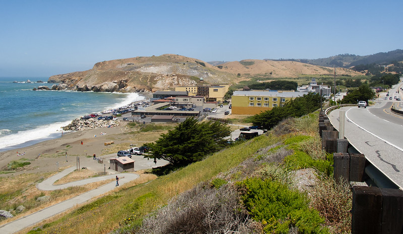
For most of its length, Highway 1 is wide and fast, with a lot of traffic but few intersections. There are some sections of parallel bike path through Pacifica, but I don’t like them much so I stay on the road. After leaving Pacifica the road narrows and heads uphill; this section is a bit uncomfortable until you get to the turnoff for the tunnel. If you’re in a hurry, the tunnel is fine, but the old Devil’s Slide road, now a bike/pedestrian path, is a really nice ride now that the cars are gone.
If you go up the old road, take a break and check out the view at the pull-out. After the peak there’s a narrow, twisty section through Devil’s Slide, mostly downhill but with a few short climbs. At the bottom of the descent the road widens and becomes a beautiful ride on rolling hills through farmland with cliffs and coves to your right. There’s usually a tailwind; outstanding big-ring cycling. There are a few business districts heading through Half Moon Bay, and then nothing until the turnoff on Tunitas Creek.
Plaza Alhambra/Magellan/Mirada/Coastal Trail/Kelly
This is an optional detour off Highway 1 through Half Moon Bay; it’s a nice set of small roads and trails through the coastal grasslands. It’s part of the Pacific Coast Bicycle Route. On weekends there are a lot of dog walkers and such. It’s a little bit longer and a good bit slower, so choose based on the kind of ride you’re up for.
Tunitas Creek Road
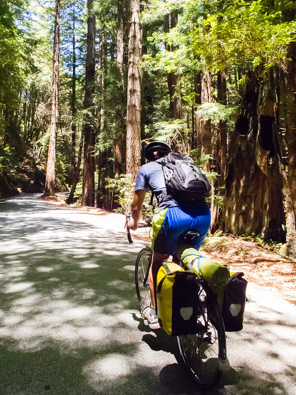
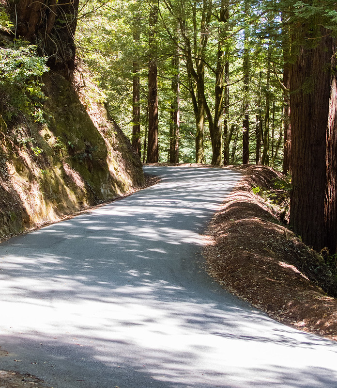
During a fast downhill, prepare to make a left on Tunitas Creek. This left turn provides a dramatic change in ride characteristics, as you go from a fast, busy downhill to a slow, quiet climb. Tunitas Creek has been featured on the Tour of California, and with good reason; it’s a consistent, challenging climb on a one-lane road through beautiful redwoods, with almost no traffic. Unquestionably among the best biking roads in the Bay Area, or anywhere else.
You probably should stop at The Bike Hut, an honor-system store with snacks, beverages, bike tools, and picnic tables.
Kings Mountain Road
Going straight across Skyline sends you down Kings Mountain Road, a fun, twisty descent through open space and parks, with limited traffic. Most, but not all of the pavement is good. Towards the bottom you head into ranch estates and into the town of Woodside. Be careful at stop signs; local cops with not enough to do like to ticket bike riders.
Cañada Road
Cañada Road is a very popular biking road on rolling hills. It’s wide, with little traffic other than bikes. About half of its length is closed to cars on Sundays.
Highway 35/Hayne/Black Mountain
This is a series of wide, rolling roads heading north on the Peninsula. Some residences, not much traffic.
Trousdale/California Drive
Trousdale is a steep descent through a residential area. It ends at California, which will take you right to Millbrae BART. You might need to ride around the block a few times if you want to get to 100km for the day.


