Mount Diablo
Mount Diablo is a much more dramatic climb than Mount Tam; it starts and pretty much goes up without interruption for 20 km. The views get gradually more panoramic as you go up, and the view from the top is one of the most panoramic in the world–on a clear day you can see Half Dome and the Farallons. It’s mostly a grind; South Gate Road is a fairly even 5% grade, and Summit Road is a fairly even 7% grade, except for a 13% footpath at the very top. The descent is epic. You can decide when you get to the halfway point whether you want to attempt the summit, or just coast downhill to BART.
Route Maps
Beginner’s (33km)
Start: Castro Valley, End: Walnut Creek
Intermediate (56km)
Start: Castro Valley, End: Pleasant Hill
Advanced (71km)
Start: Castro Valley, End: Pleasant Hill


Road notes
Norbridge/Castro Valley Boulevard (all rides)
If you can get the light to trip leaving the BART station, Norbridge lets you miss a couple of blocks of busy Castro Valley Boulevard. Castro Valley has a lot of traffic, and a short climb. On the descent, prepare to turn left on Crow Canyon Road (double left turn lane).
Crow Canyon/Norris Canyon Road (all rides)
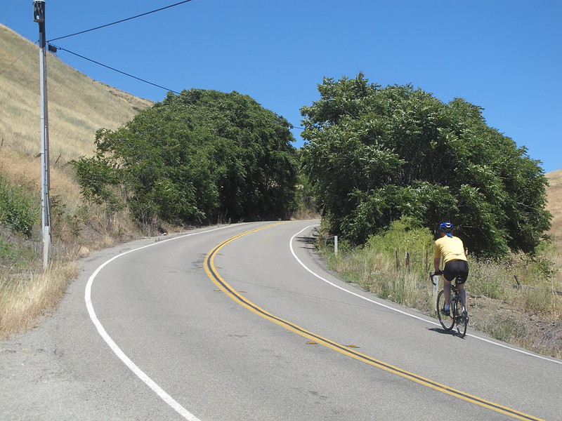
Crow Canyon is a decent road but doesn’t have as much shoulder as you’d like for the amount of traffic it gets. After leaving Castro Valley proper, there are no intersections for a while; turn right on Norris Canyon at your first opportunity. Norris Canyon is a pretty, winding road through farmland with practically no traffic. The road slopes up gradually (with occasional steep pitches), then climbs fairly steeply for 2 km. This is the hardest hill you’ll find on a beginner’s ride; it’s a good test. After the county line there’s a fun, fast descent to Bollinger Canyon Road and across to San Ramon Valley Boulevard.
San Ramon Valley Boulevard (all rides)
San Ramon Valley is a useful, mostly flat, boring road with wide shoulders and a fair bit of traffic.
Diablo Road
They’ve recently repaved much of this road and changed the signs; it used to go through some name changes but now it’s Diablo Road the whole way. It’s relatively pretty but narrow and trafficky after leaving downtown Danville.
Mount Diablo Scenic Boulevard/South Gate Road (intermediate/advanced rides)
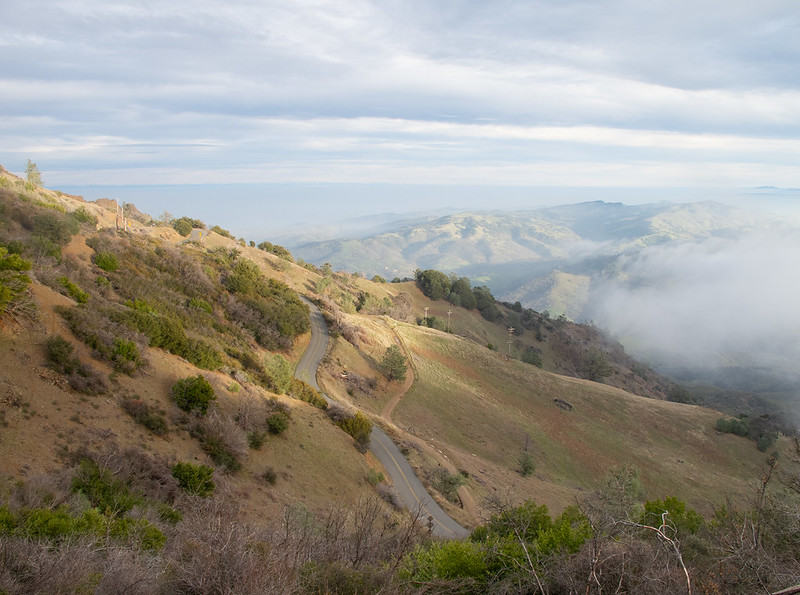
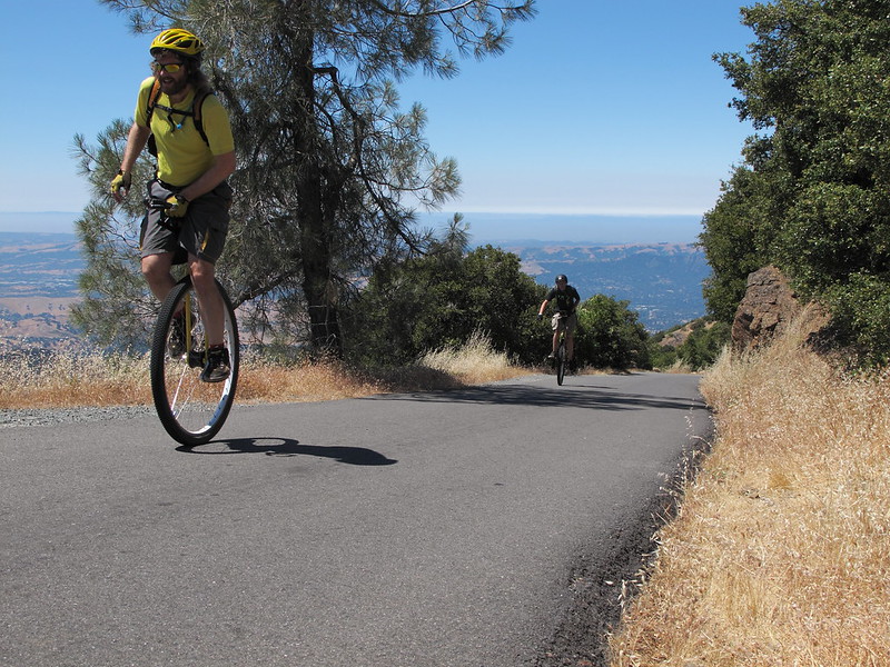
Athenian School is where the Mount Diablo climb really begins. Mount Diablo is a very straightforward hill; it holds no secrets and accepts no excuses. South Gate Road averages about a 5% grade for about 10 km. It’s a really nice ride, especially if the weather is clear, but don’t blow yourself out too early. The road surface below the entrance to the state park is horrible; the road in the state park has recently been repaved. Most of this climb is gradual but there are some steep pitches. There are some nice south and east views if it’s clear.
The gate is about 7km up; there’s a water fountain. After the gate there’s about 1 km of relatively flat road with campsites and picnic areas off to the side; most have water fountains and restrooms. The road in this area is shaded and cooler. Then the climb resumes in earnest, again around 5% with steeper pitches. Around the 2000 foot marker you pass through to the other side of the mountain; there, you get your first north view, and the climb becomes somewhat steeper. The last few hundred meters before the ranger station are steeper than the rest of the climb so far; this is where you find out if you still have the legs to attack the summit.
Summit Road (advanced ride)
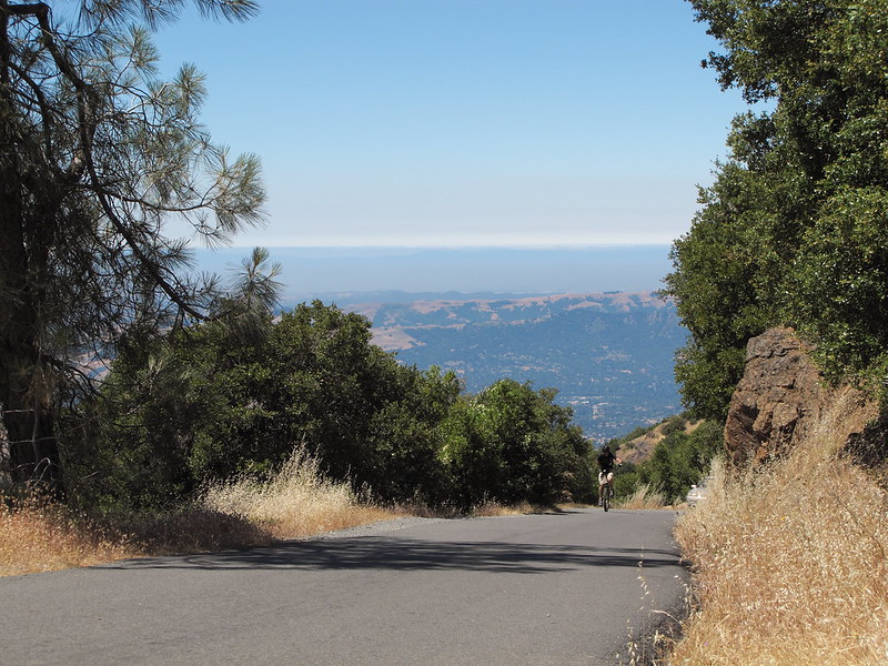
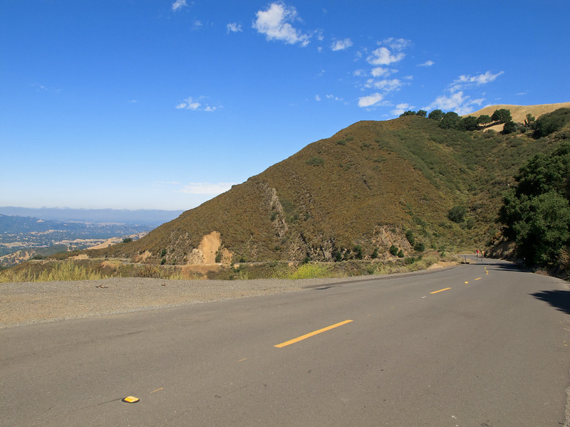
Summit Road averages about a 7% grade for 9 km; it’s a painful but rewarding climb. There is an extended section of about 9% grade, ending at Devil’s Elbow; after a brief respite, the last bit is a footpath which provides the final test for cyclists who’ve made it this far; it’s only about 200 meters, but the grade is at least 13%. If you can make it up, you’ve truly arrived at the peak. Hang out at the top, have a drink and a snack while your pulse calms down a little. On a clear day you can see east to Yosemite and the Sierra Nevada, and north to Red Bluff from the summit.
The descent on Summit Road is fun and fast. Watch out for gravel in the turns.
North Gate Road (intermediate/advanced rides)
The descent on North Gate has some fast sections but it’s more technical than speedy; lots of fun turns to carve. Watch out for potholes, gravel, and squirrels in the road.
Oak Grove Road/Contra Costa Canal Trail (intermediate/advanced rides)
Get onto Oak Grove Road by going sort of straight at the roundabout. It’s a relatively low traffic road with a bike lane. After it crosses massive Ygnacio Valley Road it gets busier; soon after that, use the traffic signal at the trail crossing to get onto the Contra Costa Canal Trail. The trail is a pleasant place for a cool down cruise. Hang a right where it hits the Iron Horse Trail and take the bike/ped bridge over busy Treat Boulevard.