Tour of Oakland
Oakland is a great city for biking, with a wide range of terrain and a ton of interesting stuff to see. This ride, 99% within the city limits, will take you through almost every part of Oakland, mostly along quiet roads or pathways. It can be done from anywhere in the city, and works either clockwise or counterclockwise. The maps start at Rockridge BART and go counterclockwise.
The beginner’s ride is almost entirely flat, with nice views of Lake Merritt and the estuary. The intermediate adds the climb up Golf Links Road to Skyline, and the advanced adds another climb through Shepard Canyon. Much of it is on signed bike routes or dedicated paths.
The two longer routes touch almost every Oakland neighborhood and most of the major parks and attractions. They are a great way to understand the city better and to experience its contradictions. Oakland is beautiful and ugly. It’s wealthy and impoverished. It’s welcoming and hostile. All across the city, freeways and other infrastructure create boundaries which divide communities.
If you keep your eyes open, you will learn something new.
Route Maps
Beginner’s (23km)
Start: Rockridge, End: Coliseum
Intermediate (61km)
Start: Rockridge, End: Rockridge
Advanced (65km)
Start: Rockridge, End: Rockridge


Road notes
Miles/Forest/Locksley/Hudson/Hardy/Frog Park/Cavour/Vicente/55th
The ride starts with a number of quick turns on mostly residential streets, with a trip through FROG Park, a cute neighborhood project next to the freeway. The turn on Claremont is sometimes tricky. 55th is protected by lights at Telegraph and Shattuck.
Adeline/14th/MLK/17th
Adeline is a former streetcar line, from back when West Oakland was the central transit hub of the East Bay. Now it’s mostly a low-volume, too-wide street. Note how the neighborhood changes after it passes under the freeway. (Slight route cheat: The block of Adeline between West MacArthur and 36th is in Emeryville.) The route turns left at DeFremery Park, which was a center of Black Panther activity. Note the neighborhood changing again when you cross over 980, and think about how the city might be different if that unnecessary freeway were removed.
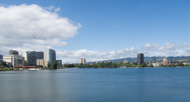
Harrison/Grand/Bellvue/Embarcadero/Lakeshore (Lake Merritt)
Lake Merritt is the jewel of the flatlands. On a nice day you’ll see everyone in Oakland here. The route stays on the lake side, making it pleasant and mellow. Children’s Fairyland, the botanical garden and the bird sanctuary are worthwhile stops.
1st Ave/E 12th St/5th Ave/Embarcadero/E 7th St.
Leaving the lake, you’ll pass Laney College and pop out on the waterfront. These are more industrial areas, with wide roads with a not too many cars but some truck traffic. Bikes get an exclusive cut-through on E 7th which keeps the road quiet.
Fruitvale/Alameda/bike path/High/Tidewater
At the Fruitvale Bridge, the route turns south along the estuary. Some portions have bike paths along the water, at others are on surface streets. The crossings at Fruitvale and High St. are busy with cars coming over the bridges from Alameda; be careful. Don’t miss the right turn into the Tidewater Boating Center driveway.
Bay Trail/MLK Regional Shoreline
A series of pathways and bridges along the estuary and inlets provide great birdwatching opportunities. These paths often have many pedestrians and dogs, so take it slow.
Zhone Way/66th Avenue/San Leandro/69th/Snell
At the wavy sculpture, hop onto Zhone Way to cross 880 and pass the Oakland Coliseum. Normally traffic is low but if there’s a game going on it can be very busy. Though all of the teams are leaving town and sticking us with the bill for the last renovations. Cross under the BART tracks and turn right; the station will be on the right (end of the beginner route). If it’s Saturday afternoon, check out the Scraper Bike Shed on 69th and International.
75th/East Bay Greenway
The East Bay Greenway is a project to provide a bike path underneath the BART tracks from Fruitvale to South Hayward. The first segment isn’t much, but it will get you from 75th to 85th without having to ride on San Leandro.
90th/Bancroft/106th/Foothill/98th
A collection of mostly quiet residential streets, with a couple of tricky intersections at International and Macarthur. 90th Avenue features the award-winning Scraper Bikeway. Bancroft, a former streetcar line, was Oakland’s first road diet project, way back in 2001.
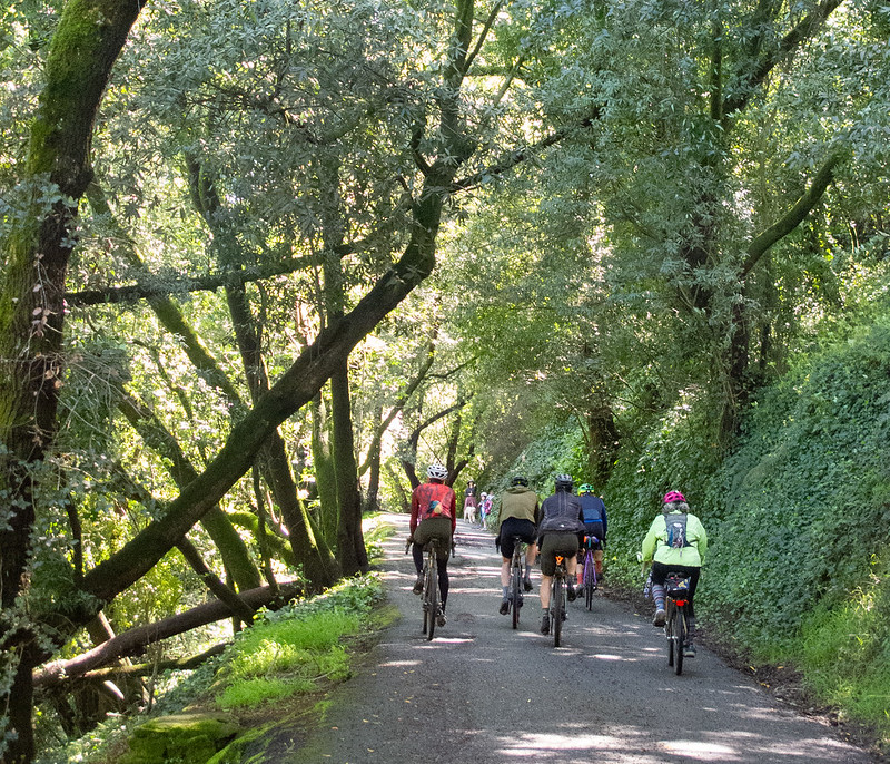
Golf Links Road/Grass Valley/Skyline
Note again how the neighborhood changes after you cross under 580. Golf Links has some of the most exclusive places in Oakland. Knowland Park can be a good stop on a nice day. Together these roads give you a good workout, a solid climb with a bunch of downs and ups added in. The center median has a dirt path which is a fun option if you’re not on skinny tires. After you pass Skyline High you get your last down and up, then the route starts descending in earnest. You’ll turn left across from the main entrance to Joaquin Miller Park, the jewel of the hills.
Robinson/Butters/Burdeck
One of the best secret routes in Oakland, these roads provide a secluded, wooded route from flatlands to hills. Butters Canyon is particularly nice. Going directly down Joaquin Miller is faster, but this is way nicer.
Mountain/El Caminito/Camino Lenada/Ascot/Scout
You can skip this slight detour if you want to avoid the short, steep climb, but I think it’s worth it for the descent on Scout, which is my favorite secret road in Oakland.
Park/Trestle Glen (intermediate route)
Park Boulevard sucks, but not as much downhill as uphill. Just past the first light on the downhill, you’ll turn on Trestle Glen, which is a quiet, mostly one-lane tree-lined residential street through fancy houses. (Possible route cheat: The boundary between Oakland and Piedmont sits near this intersection; the first couple hundred meters of the road may be in Piedmont.) It’s particularly nice in the autumn months.
Lake Merritt/Bay/27th/Webster/Shafter (intermediate route)
A glory lap around the lake, and then mostly-residential surface streets back to Rockridge.
Mountain Boulevard/Montclair Railroad Trail/Saroni/Glencourt/Arrowhead (advanced route)
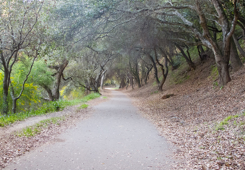
Mountain Boulevard enters the Montclair business district (good farmer’s market on Sundays); just uphill at the end of a dead end street, you can start climbing the Montclair Railroad Trail, a vestige of the days when streetcar lines prompted development here and in the farther East Bay. Interpretive signs along the route tell more of the story. The path is pleasant but tends to have lots of walkers and dogs; recommended in the uphill direction only unless you’re patient. From the top of the path, a series of steepish residential roads takes you back up to Skyline.
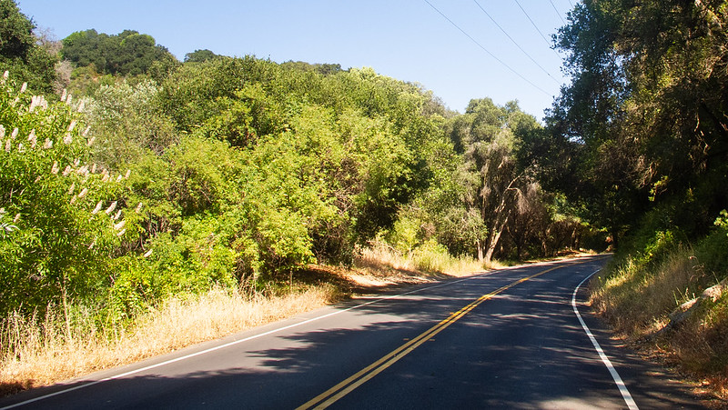
Skyline/Tunnel Road
Back on the ridge you’ll find great views of the bay, leading to the descent on Tunnel Road, probably the busiest recreational bike route in Oakland. Pavement has deteriorated recently so be careful on the faster sections.
Caldecott/Broadway/Lake Temescal/Broadway Terrace
Another optional detour; while blasting downhill, turn left just after you cross the bridge over Highway 13 to take the bike path past Lake Temescal, a good spot for a picnic, or if it’s a hot day, a dip in the lake. Broadway Terrace at this point has a wide bike lane, which will take you almost all the way back to College Ave. and Rockridge.