Mount Hamilton via Mines Road
Mount Hamilton is the tallest peak in the Bay Area, and Mines Road, which eventually approaches it from the east, is the longest, most remote road. From the edge of Livermore to the top of Mount Hamilton is over 80km, and in all that distance there’s only one establishment (the Junction Cafe). This is a scenic, quiet ride unlike any other you’ll find in the area, but it’s also an ass-kicker. Masochists can loop around to Dublin BART; the easier route is to catch BART in San Jose. Civilization and traffic are practically non-existent once you leave Livermore.
Route Maps
Advanced (129km)
Start: Dublin/Pleasanton, End: Berryessa/North San José
Masochistic (174km)
Start: Dublin/Pleasanton, End: Dublin/Pleasanton


Road notes
Owens Drive/W. Las Positas/Santa Rita/Mohr/Valley Ave
This series of roads takes you through the godforsaken wasteland of Pleasanton; abandoned office campuses, burbclaves and strip malls.
Stanley Boulevard
After a left turn at a busy intersection, Stanley Boulevard is a wide, straight road with a broad shoulder; portions have a bicycle side path. I usually take the road. It’s laser-straight for over 5km, with no traffic lights until we get into Livermore. It passes by some quarry operations as well as Shadow Cliffs Regional Recreation Area.
Murietta/Livermore/Tesla
These roads take you through what passes for downtown Livermore, and then out into the fully rural areas on the east side.
Mines Road
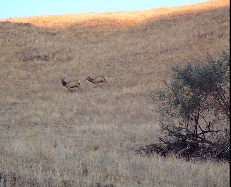
There are a couple of farms on the first part of Mines Road, and there’s a moderate amount of traffic on weekends, most of it going to Del Valle Regional Park. After 5km, the road turns to the left (going straight takes you to Del Valle), the traffic disappears and you head out onto one of the most remote roads in the Bay Area (rivaled only by Morgan Territory Road). The rugged terrain and undisturbed chaparral evoke images of spaghetti Westerns—you half-expect to see a young Clint Eastwood mounted on a nearby hillock with a rifle across his arm.
Mines is not only remote, it’s long. There are mile markers painted on the road to remind us just how far we are from any kind of civilization—they count up to the Santa Clara county line (20 miles) and down from there to the top of Mount Hamilton (26 miles). In between, there is virtually nothing except for the Junction Bar and Grill, at the intersection where Mines Road meets Highway 130 headed into the central valley towards Yosemite. The road trends upwards for what seems like forever; there’s a fairly steep climb that takes you up 300 meters, then the road starts stepping upwards, with climbs punctuated by flat sections through meadows. The terrain is unlike any other road around here.
The gradual climb takes us to 500 meters altitude at the Santa Clara county line, 35 km from the beginning of the road. The climb gets a little more serious at that point, bringing you to about 800 meters before a small descent, a moderate climb, and then a long (5km) descent to the Junction. After the first peak, you encounter the first of the cattle guards which are to be your companion all the way to San Jose. Hit them straight-on and with momentum.
Stop at the Junction for water, if nothing else. I’d recommend bottled; the tap water is heavily mineralized. There is also a restaurant, bar, pool table, library, and post office if you need any of those. Bring cash if you want a snack; the Junction is cash-only.
San Antonio Valley Road
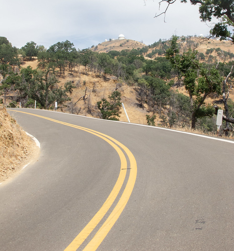
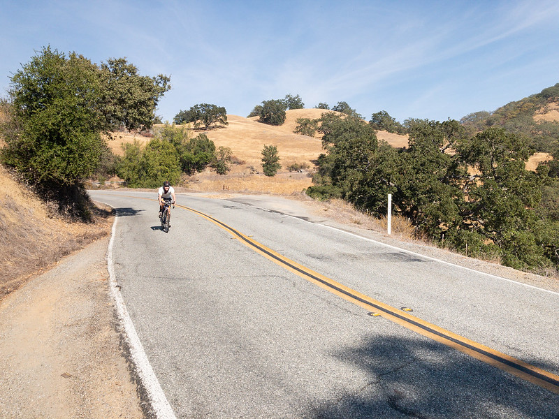
Bearing right at the junction takes you onto San Antonio Valley Road, which gets even more desolate past the junction; you’re unlikely to see anything other than other cyclists or motorcycles doing the same ride. The road is straighter and flatter for almost 10km, then there are two noticeably long, fairly steep climbs over ridges, with descents on the other side. At the top of the second ridge; you get your first view of something near the peak of Mount Hamilton itself; while Hamilton is the tallest peak in the Bay Area, it’s in the middle of a ridge which hide it from ground observation at most angles.
The road crosses Isabel Creek, which marks the beginning of the real climb. Because you’ve been climbing already, you don’t have to do 1200 meters in one shot, but it’s still over 600 meters, and steeper than the Diablo or Tamalpais climbs. Here’s where you find out if you’ve bitten off more than you can chew, although if it turns out you have, there’s not much to do other than keep pushing up the hill. Ain’t no Uber gonna come by out here.
Eventually you’ll reach the Lick Observatory complex at the peak (Mile 0, painted on the road). There’s water and vending in the public buildings, and some touristy things to do if there’s time (visitor center open until 5PM).
Mount Hamilton Road
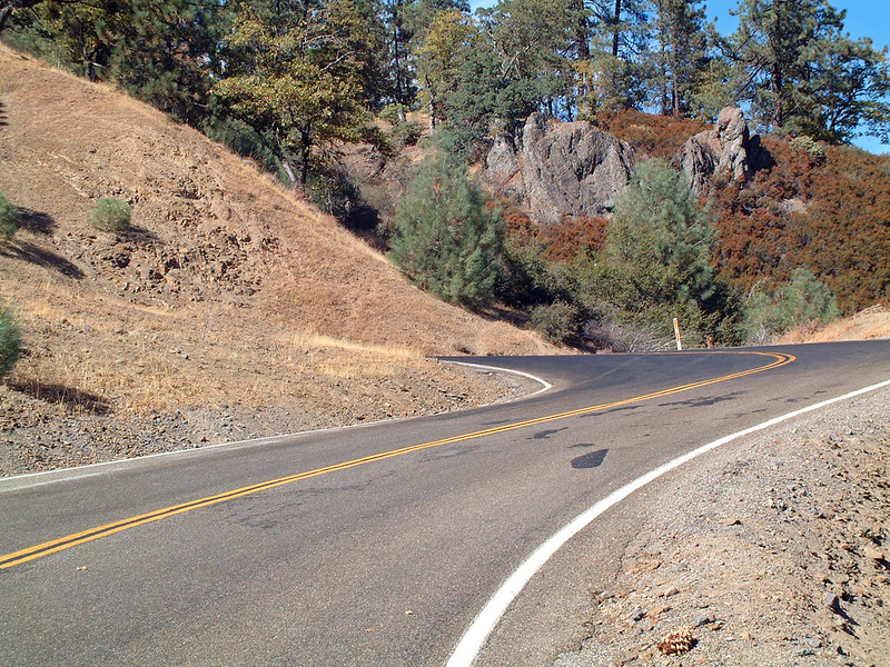
The descent on Mount Hamilton Road is fairly gentle and twisty; they had to cut the road with grades below 7% so horses could pull up the huge 36-inch telescope lenses they installed here back in 1888. (Lenses, not mirrors, back then—the largest telescope up here now is a 120-inch mirror, and it’s still used for serious science.) The bottom part of the road was repaved in 2020 so it’s pretty sweet. Unfortunately, the descent is interrupted twice by noticeable climbs so it’s not all sweetness.
Alum Rock/Valley View/McKee/White/Mabury (advanced ride)
As you enter North San José, the traffic gets heavier. These roads mostly have decent bike lanes, or occasional side paths if you prefer those. The Berryessa BART station will be on your right on Mabury.
Calaveras Road (masochistic ride)
Calaveras is a beautiful road that parallels the Calaveras Reservoir for much of its length. There’s a fairly steep climb out of San Jose, then a gradual, rolling descent into Sunol, where it ends at Highway 84.
Pleasanton/Sunol Road, Foothill Boulevard (masochistic ride)
Pleasnaton/Sunol and Foothill are reasonable roads through rolling hills, with moderate traffic and moderate shoulders.