The Cheese Factory Century
This 100+ mile ride features a broad variety of terrain and microclimates, and a midway stop at The Cheese Factory in Marin for sandwiches and relaxation. The intermediate ride could be an easy advanced ride. The beginner’s ride is a popular circuit around the outskirts of San Francisco, through Golden Gate Park and the Presidio. Traffic varies from light to heavy; the civilization level is fairly high. There aren’t a lot of possible centuries around here which are easier and more enjoyable than this one. (Harder is possible).
Route Maps
Beginner’s (27km)
Start: Daly City, End: Embarcadero
Intermediate (78km)
Start: Daly City, End: Embarcadero
Advanced (163km)
Start: Daly City, End: Embarcadero


Road Notes
Saint Charles Avenue/19th Avenue/Beverly Street/Holloway Avenue/Font Boulevard/Lake Merced (all rides)
Exit Daly City BART on the parking lot side; leaving the parking lot puts you on Saint Charles, a residential street. A pathway at the end switches back down the hill to cross Brotherhood, then a few more turns will get you through Park Merced to Lake Merced, and then to Sloat and the Great Highway. Most of the roads are fine, but watch the intersections which are at odd angles.
The Great Highway (all rides)
The Great Highway, now Sunset Dunes Park, is a blast if the weather is right. This section is closed to cars, and it’s rail-straight, and fast if there aren’t a lot of pedestrians. Officially, bikes are supposed to be on the east roadway. Be aware of drifting sand on the road, and if the weather is nice, lots of pedestrians and dogs. At the windmill, turn into Golden Gate Park.
Golden Gate Park (all rides)
Golden Gate Park is relatively quiet and pretty. All the roads are wide and well-paved. Most of them have rolling hills. The west side of the park often has a lot of cars parked on the road. Note: The left turn onto Crossover Drive may not be marked; it’s just before JFK Drive goes underneath Highway 1/19th Ave.
23rd Avenue (all rides)
Now a Slow Street, this has become the bike-preferred way to cross the Richmond District.
Lincoln Boulevard/McDowell Ave/Mason Street (all rides)
Lincoln is a wide road with moderate traffic through the Presidio. There’s a good climb up towards the bridge, then a descent back towards it; to get to the bridge, turn left into the parking lot just before going underneath the freeway, then get on the gravel path across the footbridge.
Coming back from the Golden Gate, there’s a wide, fast descent, then a left turn on Crissy Field Avenue (steep downhill) puts you on Mason Street by Crissy Field. Mason often has a blasting tailwind, and it has a long straight section to try out your big ring. Unless you are really hammering, hop on the bike/walk path to the left just before you leave the Presidio.
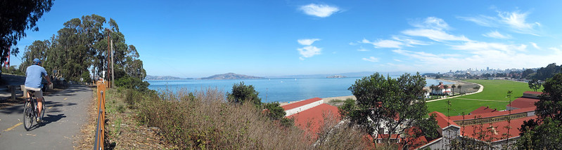
Marina/Fort Mason/North Gate/Embarcadero (all rides)
After leaving the Presidio you can take bike/walk pathways to Aquatic Park. If you’re in a hurry just stay on Marina to Bay Street, but for a more relaxed ride, stay with the pedestrians, dogs, and Blazing Saddles riders through Fort Mason. Watch the descent to Aquatic Park, it’s steep with bad pavement and posts at the end.
North Gate is the most relaxed way across town. Embarcadero has a decent bike lane and takes you to the Ferry Building, where you make a right to get to Embarcadero BART.
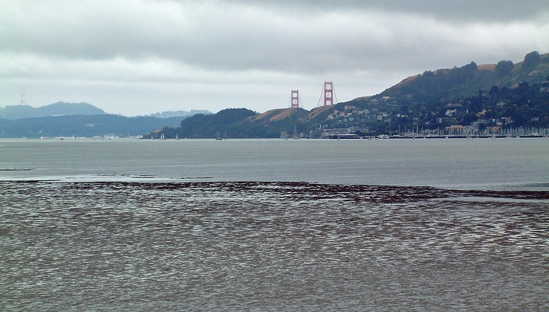
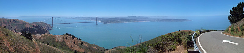
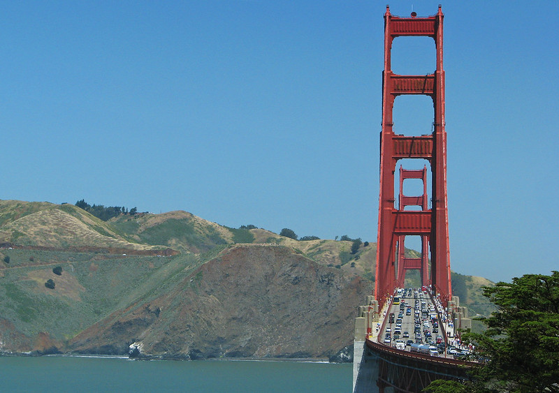
Golden Gate Bridge (intermediate/advanced rides)
I usually don’t enjoy riding on the bridge; it’s narrow, shared by two-way bike traffic (much of which is inexperienced tourists), it’s noisy, and there’s often strong winds and fog. That being said, it can be spectacular on a good day. Pay attention to what you’re doing; stop at one of the notches if you want to look at the view.
Conzelman Road/Sausalito Lateral/Bridgeway (intermediate/advanced ride)
A twisty, fun descent under the bridge takes you down to East Fort Baker, then a climb brings you up to a wide, busy road into and through Sausalito. The descent into town is twisty and fairly narrow; you probably should take the lane. Once in town, there are usually large crowds of pedestrians and slow-moving cars; keep an eye out. After leaving downtown it’s more reasonable. Where the road goes onto the freeway, get onto the bike path on your right.
Mill Valley-Sausalito bike path (advanced ride)
On weekends the traffic on this path can be out of control; watch out for dogs and people wobbling all over the place. Other than that it’s reasonably pleasant.
East Blithedale/Greenwood Cove/bike path/Tiburon Boulevard (advanced ride)
East Blithedale is busy, with a partially protected bike lane. Crossing the freeway sucks, but after that you can get off it on a parallel set of roads and paths on the bay side. The paths go almost all the way into downtown Tiburon. Stop in town for a snack, or to grab the ferry back.
Paradise Drive/Trestle Glen (intermediate/advanced ride)
Paradise Drive starts with a climb, then rolls through quiet, beautiful woodland by the bay. There’s very little traffic. The pavement is often not great. At the fire station, the intermediate ride turns left on Trestle Glen, which climbs a short hill and then descends back to East Blithedale to complete the loop. If you want a little extra you can stay on Paradise into Corte Madera and then climb over Corte Madera Avenue.
Pathways to Larkspur Landing (advanced ride)
A collection of pathways and sidewalks leads to Redwood Highway Frontage Road; a pathway starting on the left side of the road takes you over a bridge to the ferry terminal.
SMART Train/Highway 101 pathways (advanced ride)
A number of pathways have been developed along the SMART train corridor and Highway 101, most notably the Cal Park Hill Tunnel just north of Larkspur Landing. The pathways are fine, the intersections are often awkward. They also are still under development, so conditions may change (hopefully for the better).
Lincoln/Los Ranchitos/Northgate/Las Gallinas/Miller Creek/bike path (advanced ride)
This set of roads and bike paths parallels the freeway. The roads are mostly wide, with moderate traffic.
Ignacio/Sunset (advanced ride)
These are quiet roads through residential areas and the old air force base housing.
Cambridge/Arthur/Indian Valley/Mill/Sutro (advanced ride)
This set of roads on the edge of Novato adds a little bit of climbing in exchange for avoiding downtown.
Novato Boulevard (advanced ride)
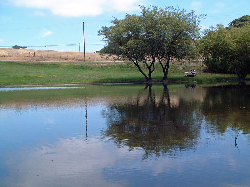
Novato Boulevard has some traffic, which gradually lightens as it heads into the pastures to the west, where the climb up into central Marin begins. The climb is long and hot but mostly not steep; there are a few downhill sections to break it up. There’s often a headwind as you go up.
Pt. Reyes/Petaluma Road (advanced ride)
Shortly after the left turn onto this road, take a break at the Marin French Cheese Company on your right. There’s a small store where you can buy sandwiches, beverages, cheese and crackers. After the stop, the road continues through the fields, gradually climbing. This section is narrow and has a fair bit of high-speed traffic; be careful.
Nicasio Valley/Lucas Valley/San Geronimo Valley (advanced ride)
These are pleasant, quiet roads through the pastures and back into the redwoods. Lucas Valley was not named for George Lucas, but Skywalker Ranch is located along the road.
Red Hill/San Antonio/Bolinas/Shady/Lagunitas/Ross Common/Poplar/Kent (advanced ride)
The town of Ross doesn’t like people from out of town. Most of the bicyclists through here come from out of town. So instead of making Sir Francis Drake safe for bikes by widening it, they created this convoluted “bike” route, and the cops often sit around and ticket bicyclists who roll through the many stop signs. (Not like there’s anything else for cops to do in Ross). You can avoid this silliness by staying on Sir Francis Drake, but it’s narrow and busy.
Corte Madera Ave (advanced ride)
After passing through town, there’s one more decent climb and a fast descent back towards Mill Valley and the bike path.