The Tiburon Loop
The Tiburon Loop is one of the most popular rides in the area, pleasant and rolling, with very little traffic once you pass through downtown Tiburon. You can also take the ferry back from Tiburon or Sausalito to San Francisco, which many “advanced intermediate” cyclists do on this route. The intermediate route tacks on perhaps the craziest descent in the area, on Conzelman Road. Civilization level is high, and traffic is light except going through Sausalito and into Tiburon.
Route Maps
Beginner’s (27km)
Start: Daly City, End: Embarcadero
Intermediate (48km)
Start: Daly City, End: San Francisco (Embarcadero)
Advanced (77km)
Start: Daly City, End: San Francisco (Embarcadero)


Road notes
Saint Charles Avenue/19th Avenue/Beverly Street/Holloway Avenue/Font Boulevard/Lake Merced (all rides)
Exit Daly City BART on the parking lot side; leaving the parking lot puts you on Saint Charles, a residential street. A pathway at the end switches back down the hill to cross Brotherhood, then a few more turns will get you through Park Merced to Lake Merced, and then to Sloat and the Great Highway. Most of the roads are fine, but watch the intersections which are at odd angles.
The Great Highway (all rides)
The Great Highway, now Sunset Dunes Park, is a blast if the weather is right. This section is closed to cars, and it’s rail-straight, and fast if there aren’t a lot of pedestrians. Officially, bikes are supposed to be on the east roadway. Be aware of drifting sand on the road, and if the weather is nice, lots of pedestrians and dogs. At the windmill, turn into Golden Gate Park.
Golden Gate Park (all rides)
Golden Gate Park is relatively quiet and pretty. All the roads are wide and well-paved, and now the route through the park is almost entirely car-free. Be careful making the awkward turn onto 25th Avenue as you leave the park.
23rd Avenue (all rides)
Now a Slow Street, this has become the bike-preferred way to cross the Richmond District.
Lincoln Boulevard/McDowell Ave/Mason Street (all rides)
Lincoln is a wide road with moderate traffic through the Presidio. There’s a good climb up towards the bridge, then a descent back towards it; to get to the bridge, turn left into the parking lot just before going underneath the freeway, then get on the gravel path across the footbridge.
Coming back from the Golden Gate, there’s a wide, fast descent, then a left turn on Crissy Field Avenue (steep downhill) puts you on Mason Street by Crissy Field. Mason often has a blasting tailwind, and it has a long straight section to try out your big ring. Unless you are really hammering, hop on the bike/walk path to the left just before you leave the Presidio.
Marina/Fort Mason/North Point/Embarcadero (all rides)
After leaving the Presidio you can take bike/walk pathways to Aquatic Park. If you’re in a hurry just stay on Marina to Bay Street, but for a more relaxed ride, stay with the pedestrians, dogs, and Blazing Saddles riders through Fort Mason. Watch the descent to Aquatic Park, it’s steep with bad pavement and posts at the end. Or, if you’re willing to do some sidewalk riding, take the pathways and driveways through Fort Mason to the gate near Van Ness and Bay, and ride down to North Point.
North Point is the most relaxed way across town. Embarcadero has a decent bike lane and takes you to the Ferry Building, where you make a right to get to Embarcadero BART.
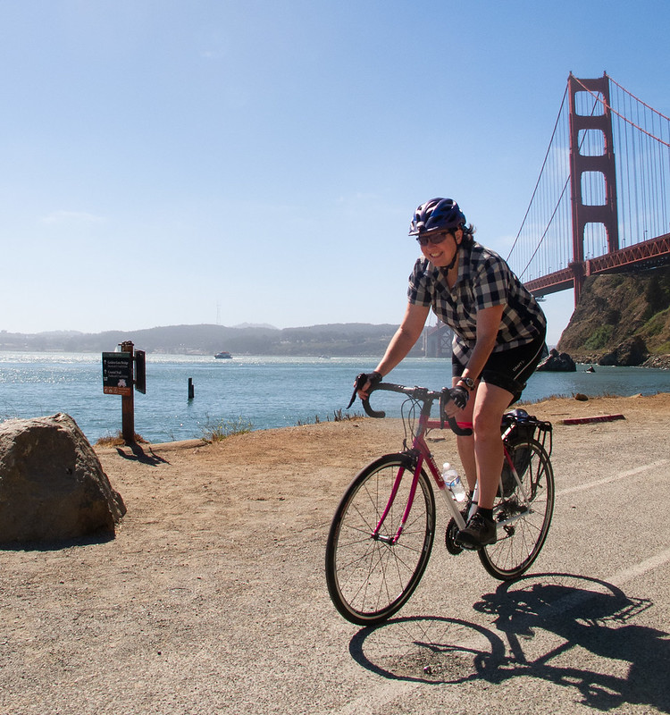
Golden Gate Bridge (intermediate/advanced rides)
I usually don’t enjoy riding on the bridge; it’s narrow, shared by two-way bike traffic (much of which is inexperienced tourists), it’s noisy, and there’s often strong winds and fog. That being said, it can be spectacular on a good day. Pay attention to what you’re doing; stop at one of the notches if you want to look at the view.
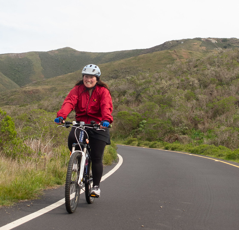
Conzelman Road (intermediate ride)
Conzelman is a GGNRA road; the speed limit is never above 25 and in fact is 15 for most of its length. It tends to have moderate traffic. Conzelman climbs steeply for a bit, then less steeply for a while; with awesome views of the bridge, the headlands, and San Fransisco all along its length. You might want to stop to rest at one of the “vista point” turnouts. At the very top of the hill there’s yet another great view. I usually wait at the peak for a significant gap between cars, because afterwards it becomes a narrow one-way street with a descent that is stunning in every sense of the word; do not let your speed get out of control. The really steep part ends after about 2 km and it flattens out, then climbs for a short stretch, than has a more controlled and fun descent on the way to the Point Bonita Lighthouse. Continue past the pedestrian footpath and stop at a lot overlooking Bird Island. It’s a great place for birdwatching if you’re into that, and there are sometimes whales offshore as well. If it’s not too chilly, this is a good place to stop for a snack.
Field/Simmon/Bunker Road (intermediate ride)
Field/Simmon/Bunker Road is fairly wide and starts with a nice tailwind-aided descent through the rolling hills of the headlands. After about 2 km it starts to climb until it enters a tunnel between West and East Fort Baker. The tunnel is sloped downwards and has a tailwind in this direction, but it’s only one lane (for both directions), so be alert. Wait for traffic to clear and get a good head of steam; it’s slightly downhill, with a tailwind. Fun! Try to stay in the middle of the tunnel; the bike lane is usually not usable due to debris and sand.
Sausalito Lateral/Bridgeway (advanced ride)
This is a wide, busy road into and through Sausalito. The descent into town is twisty and fairly narrow; you probably should take the lane. Once in town, there are usually large crowds of pedestrians and slow-moving cars; keep an eye out. After leaving downtown it’s more reasonable. Where the road goes onto the freeway, get onto the bike path on your right. (Or on the way back, do the diagonal crossing at the signal).
Mill Valley-Sausalito bike path (advanced ride)
On nice weekends the traffic on this path can be out of control; watch out for dogs and people wobbling all over the place. Other than that it’s reasonably pleasant.
East Blithedale/Greenwood Cove/bike path/Tiburon Boulevard (advanced ride)
East Blithedale is busy, with a partially protected bike lane. Crossing the freeway sucks, but after that you can get off it on a parallel set of roads and paths on the bay side. The paths go almost all the way into downtown Tiburon. Stop in town for a snack, or to grab the ferry back.
Paradise Drive/Trestle Glen (advanced ride)
Paradise Drive starts with a climb, then rolls through quiet, beautiful woodland by the bay. There’s very little traffic. The pavement is often not great. At the fire station, turn left on Trestle Glen, which climbs a short hill and then descends back to East Blithedale to complete the loop. For a slightly longer ride with a bit more climbing, you can continue past the fire station and take Paradise Drive all the way into Corte Madera, then come back to the bike path via Corte Madera Ave./Camino Alto.